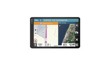
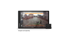
Garmin Tread Base Edition Powersport navigation device 5.5 inch
Our service

Order hotline
+49 (0)9181 / 330 100Mon. - Sat.: 8:00 - 20:00 hrs
Specialist advice
ARRANGE CALLBACKMon. - Fri.: 9:00 - 16:00 o'clock
Secure payment with SSL encryption
Free return
Up to 5% bonus with the Berger advantage card
Product details
| Very robust | Extra bright display |
| Trail navigation | ABC Sensors |
| Inreach Compatibility |
Product description
Discover the unknown
Spend your time whizzing through the woods. Stay on the right path with this durable powersport GPS navigator.
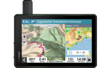
Navigate unpaved roads and trails with OpenStreetMap (OSM), using trail navigation with turn-by-turn directions.
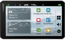
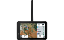
The durable Tread off-road GPS navigator is IPX7 weather-resistant and features a 5.5-inch glove-operated touchscreen.
Use the Tread app to sync data across multiple devices. ( To use this feature, you must have the Tread app downloaded to your compatible smartphone with Bluetooth technology. It also requires an active cellular signal connection and pairing with the Tread navigator)
Download BirdsEye satellite images directly to the Tread - no computer required.
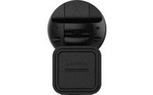
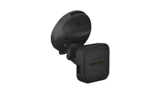
Easily mount the unit to your powersport vehicle with the included powered bracket and harness with tube mount.
Tough off-road
Designed for off-road use, the Tread can take on any weather. The unit is water resistant to IPX7 and is designed to U.S. Military Standard 810 for thermal performance and shock resistance.
Easy-to-read display
The Tread Navi's 5.5-inch extra-bright display is glove-friendly and easy to read even in bright sunlight or when it's pitch black. The device can be mounted in portrait or landscape mode.
Trail navigation
Navigate with OpenStreetMap (OSM) on dirt roads and trails using trail navigation with turn-by-turn directions. (Map data may be subject to limitations on some suggested routes for roads and trails. Follow directions on road signs at all times when guiding the vehicle and pay attention to road conditions at the time. Garmin OpenStreetMap products are intended only as a supplemental navigation aid and should not be used for purposes requiring precise measurements of directions, distances, positions, or topography)
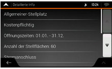
Topography
Topographic and road maps of Europe, Africa, including Tracks4Africa, the Middle East, North and South America, Australia and New Zealand are preloaded on the Tread.
Satellite images
Download high-resolution BirdsEye satellite images directly to your navigation device via Wi-Fi. No annual subscription needed
Easy device sync
Use the Tread app to sync waypoints, tracks, routes, and collections across multiple devices, including your mobile device, computer, and Tread nav. It's also easy to import and share GPX files. ( To use this feature, you must have downloaded the Tread app to your compatible smartphone with Bluetooth technology. It also requires an active cellular signal connection and pairing with the Tread navi)
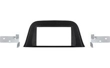
Multiple mounting options
Included are a powered mount, wiring harness with tube mount, and handlebar mount so you can mount the Tread nav on your powersport vehicle and ride through rough terrain.
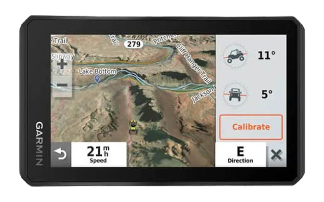
ABC Sensors
To help you navigate tough terrain, sensors like an altimeter, barometer, compass, and longitudinal and lateral slope indicators are built into the device.
Inreach Compatibility
Pair the Tread powersport navigator with one of the compatible inReach satellite communication devices (sold separately) to take advantage of two-way text messaging, interactive SOS emergency calls and weather forecasts. (Active satellite subscription required for inReach device. In some jurisdictions, the use of satellite communication devices is regulated or prohibited by law. It is your responsibility to know and follow all applicable laws in the jurisdictions where the device will be used)
Route Guidance Everywhere
Use turn-by-turn directions with announcement of street names when you are back in civilization with the Tread and want to navigate on the road.
Perfect dog tracking
Pair the Tread wirelessly with specific Garmin GPS dog systems (sold separately) to locate and retrieve your dogs in the field. You'll see markers for each dog in tracking range, with the information overlaid directly on the navi's map page. Directional markers help you track and locate each dog with ease
Group Ride Mobile
Locate friends via your compatible smartphone or Tread device when both you and your friends use the Group Ride mobile feature in the Tread app.
User-friendly route planner
Easily plan routes with the Tread app using the same maps, vehicle profiles, and route preferences as on your Tread device.
Live weather data
Is bad weather forecast for your route? Pair the Tread device with your compatible smartphone and download the Tread app to access live weather data, animated radar images, and more. (To use this feature, you must have the Tread app downloaded to your compatible smartphone with Bluetooth technology. It also requires an active cellular signal connection and pairing with the Tread nav)
Accessory operation
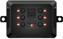
Pair the Tread with the compatible Garmin PowerSwitch digital control box (sold separately) to activate display controls for your side-by-side vehicle's 12-volt devices, such as light bars, differential locks and more.
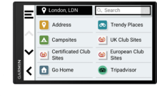
Points of Interest
The Tread comes preloaded with iOverlander POIs (Points of Interest) so you don't need a cell signal to find your way to popular, remote and hard-to-find campsites.
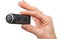
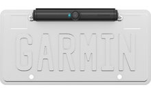
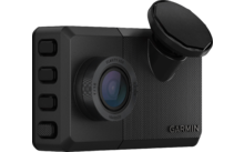
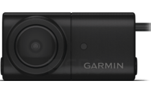
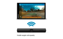
Wireless camera
What's near you? Maximize your visibility by pairing the Tread nav with a durable BC 40 wireless camera with tube mount (sold separately). Easily mounts to the vehicle's tube frame, instrument panel or roll cage.
Music for the ride
an integrated media player lets you easily play music stored on your compatible smartphone and control it through the navi's display. Sound is output through your helmet or headset (sold separately) with Bluetooth technology.
Details
- Dimensions (W x H x D): 8.8 x 14.8 x 2.4 cm (5.8 x 3.5 x 1 inch)
- Display size, W X (W x H): 12.1 x 6.8 cm (4.8 x 2.7 inches); 13.9 cm (5.5 inches) diagonal
- Display resolution, W X H: 1280 x 720 pixels
- Display type: Multitouch glass display, HD TFT color display with enormous brightness and white backlighting
- Rotatable display: Yes
- Weight: 262 g (9.2 ounces)
- Water resistance: IPX7
- Battery: Lithium-ion battery
- Battery life: Up to 6 hours (up to 3.5 hours with backlight at 100%)
- Drop test rating: MIL-STD-810
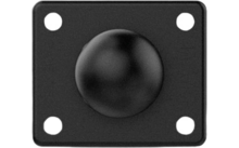
- Pipe mount (3.81 TO 6 CM/1.5 TO 2.375 INCH): Yes
- RAM ball adapter with AMPS plate: Yes
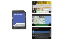
Cards and Memory
- Pre-installed cards: Yes
- Data cards: microSD card (not included)
- 3D terrain: Yes
- Internal memory: 32 GB
- Ability to add cards: Yes
- Storage and performance capacity: Yes (256 GB max microSD card)
- Included map update: Yes
- Downloadable satellite images Yes (BirdsEye)
Sensors
- GPS: Yes
- Galileo: Yes
- Barometric altimeter: Yes
- Compass: Yes
Outdoor recreation features
- Point-to-point navigation: Yes
- Preloaded topographic maps: Yes
- Track navigation: Yes
- Trail navigation with turn-by-turn directions: Yes
Camera features
- Rear view camera compatibility: Yes (BC 40 or BC 50)
Navigation features
- Garmin Real Directions route guidance: Yes
- Tripadvisor ratings for points of interest: Yes
- Route customization by preferred city/street: Yes
- Traffic data updates Yes (with Garmin Tread app)
- Intersection view with traffic signs: Yes
- Calls via Bluetooth Yes, works with Bluetooth helmets, headsets or smartphones. BLE-enabled.
- Speed limits (Shows maximum allowed speed for most roads): Yes
Advanced features
- Smart notifications via the Garmin Drive app: Yes
- Map and software updates via Wi-Fi: Yes
- Access to live services via the app: Yes
Camping features
- User-friendly route planner with Gpx file sharing: Yes
Overlanding features
- Pairing with compatible Inreach devices: Yes
- Pairing with Garmin Powerswitch: Yes
- Compatible with Group Ride Tracker: Yes
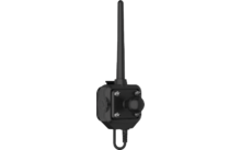
- Compatible with external GPS antenna, with mount: Yes
- Compatible with external Inreach satellite antenna
- Group Ride mobile: Yes (with Garmin Tread app)
- Track recording (DRIVE): Yes
- Ioverlander POIS (Points Of Interest): Yes
- Acsi, Campercontact and Trailer's Park: Yes
- Displays for longitudinal and lateral inclination: Yes
- Birdseye Satellite Images (Download Via Wlan): Yes
Outdoor applications
- Dog tracking: Yes (when paired with a compatible dog tracking system)
Scope of delivery
- Tread - Base Edition
- Interchangeable frame set (blue, black, red, green)
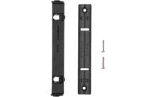
- Tube mounting kit
- Handlebar mount
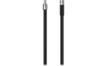
- High power cable
- USB cable
- Documentation
Features
| Type navigation systems | Navigation device |
| Resolution | 1280 x 720 Pixel |
| Bluetooth | |
| Display diagonal | 5,5 " |
| Design | Tread Base Edition |
| Colour | Black |
| Weight | 262 g |
Note
Please note: since our deliveries may contain batteries (single-use and rechargeable),
according to the German Law on Batteries (BattG) we must advise you of the following:
single-use and rechargeable batteries must not be disposed of along with domestic waste, but rather you are legally required to return used batteries. Used batteries may contain damaging substances which, if not stored or disposed of appropriately, may damage the environment or your health. Batteries may, however, also contain important raw materials, such as, for example, iron, zion, magnesium or nickel, which can be recycled. Once used, you may either send the batteries back to us, or return them in
your vicinity (e.g. at the shop, communal recycling points or at our expedition warehouse) - free of charge. When returning used batteries to points of sale, the quantity you are allowed to return is limited to the quantity typical for a single end user, and to those batteries which the seller offers or used to offer in their product range.

The symbol with a rubbish bin crossed out means that you must not dispose of single-use and rechargeable batteries
along with the domestic waste. Underneath this symbol you will also find the following symbols which have the following
meanings:
Pb: battery contains lead
Cd: battery contains cadmium
Hg: battery contains mercury
Return address:
Fritz Berger GmbH
Fritz-Berger-Str. 1
D - 92318 Neumarkt
Our service
Order hotline
+49 (0)9181 / 330 100Mon. - Sat.: 8:00 - 20:00 hrs
Specialist advice
ARRANGE CALLBACKMon. - Fri.: 9:00 - 16:00 o'clock
Secure payment with SSL encryption
Free return
Up to 5% bonus with the Berger advantage card